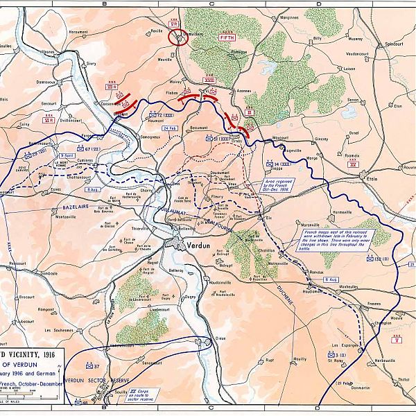
Verdun and vicinity, 1916
Situation 21 February 1916 and German Gains.
Area Regained by French, October-December 1916.
Scale in miles.
maps946
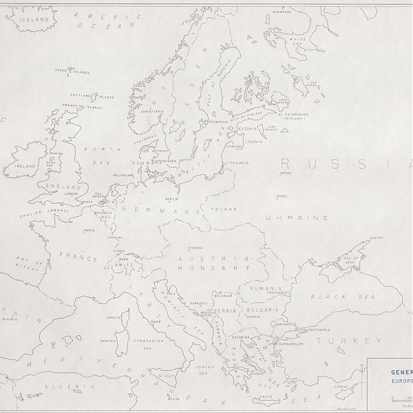
General Map
Scale of miles.
maps853
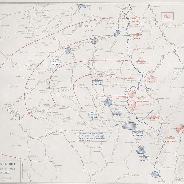
Western Front, 1914
Scale in miles.
maps854
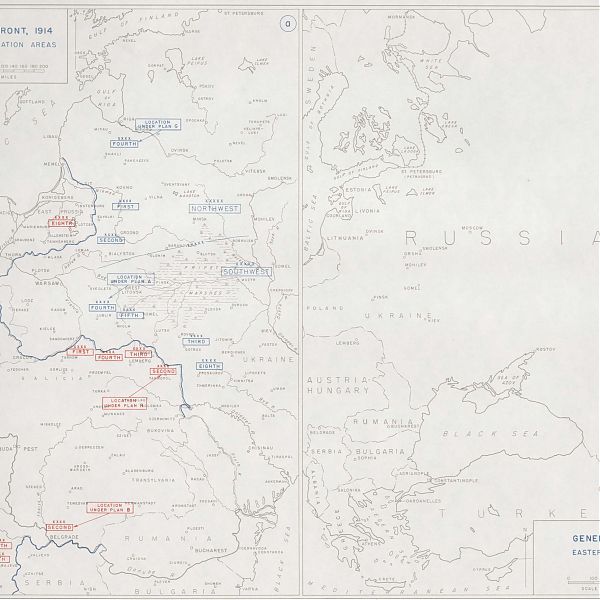
Eastern Front, 1914
Scale in miles.
maps855
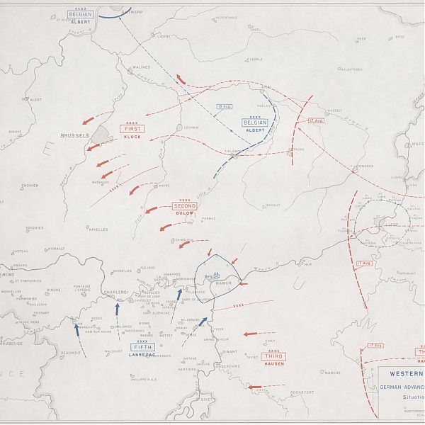
Western Front, 1914
Situation 20 August.
Scale in miles.
maps856
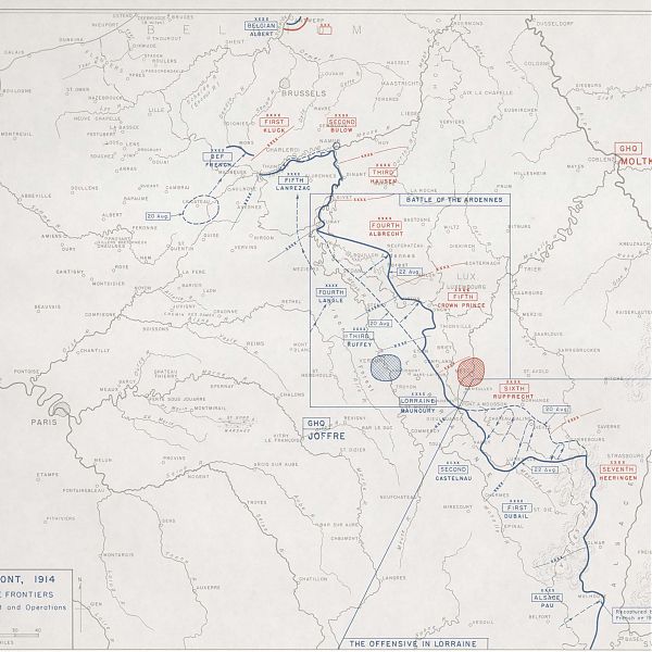
Western Front, 1914
Situation 22 August and Operations Since 20 August.
Scale in miles.
maps858
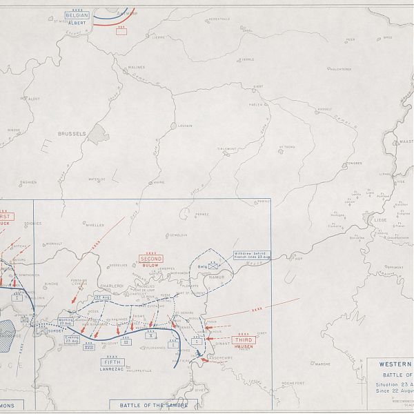
Western Front, 1914
Situation 23 August and Operations Since 22 August.
Scale in miles.
maps860
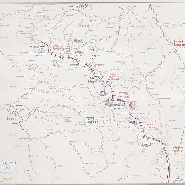
Western Front, 1914
Situation Early 26 August.
Scale in miles.
maps859
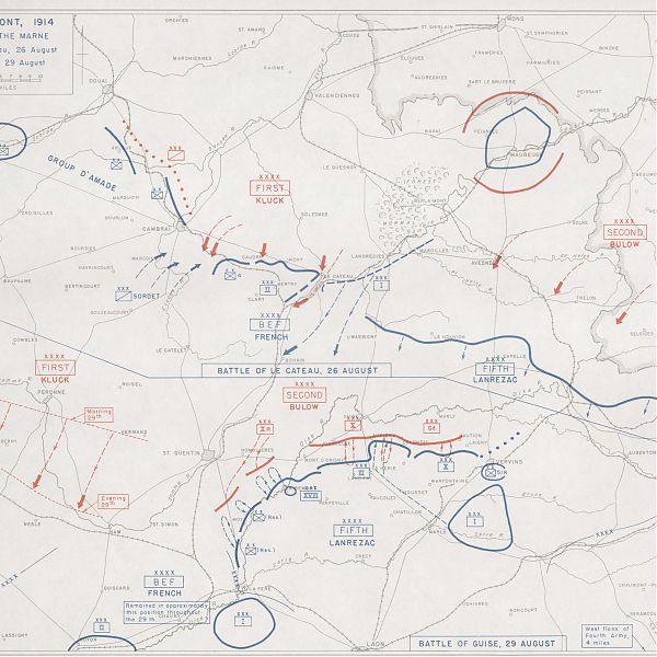
Western Front, 1914
Battle of Le Cateou, 26 August.
Battle of Guise, 29 August.
Scale in miles.
maps857